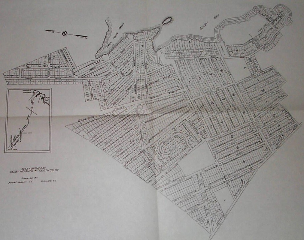
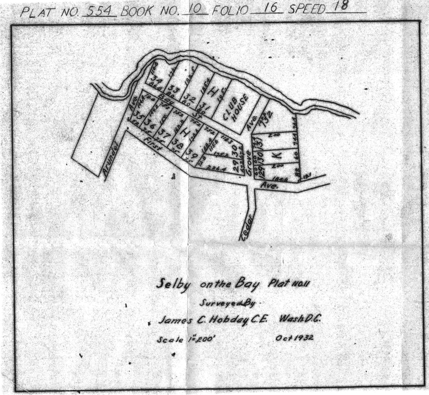
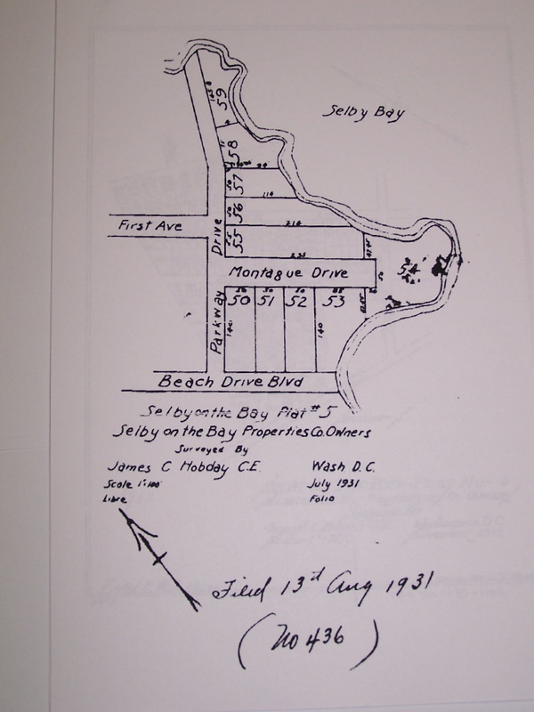
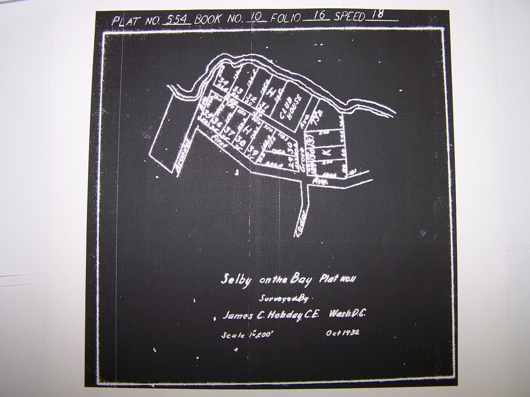
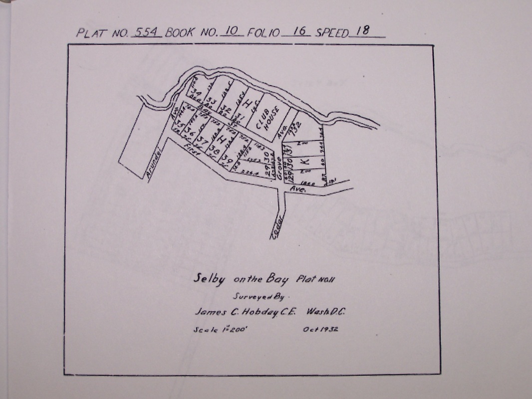
1932 Selby-On-The-Bay Plat

Plat of Selby Heights Block S
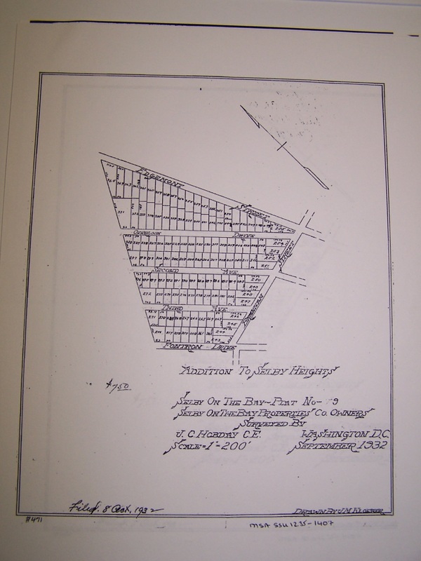
Addition to Selby Heights September 1932
K-50 parcel subdivision January 1931
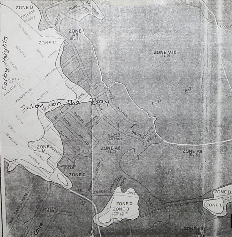
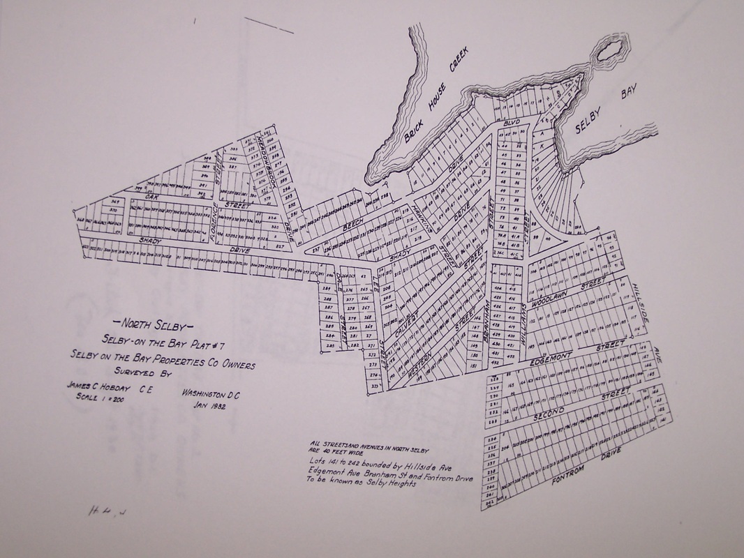
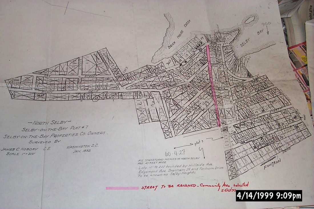
North Selby sectional zoning map 051104
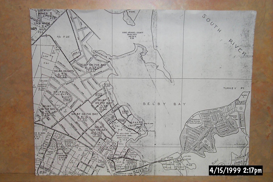
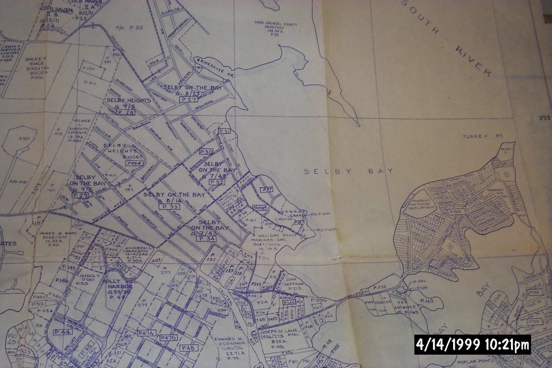
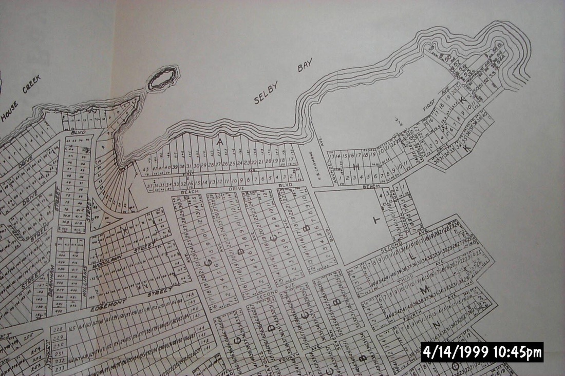
Partial AACo roads reference map of Selby and Turkey Point areas 1999

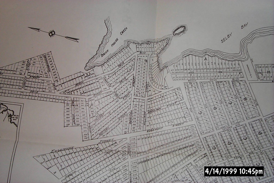
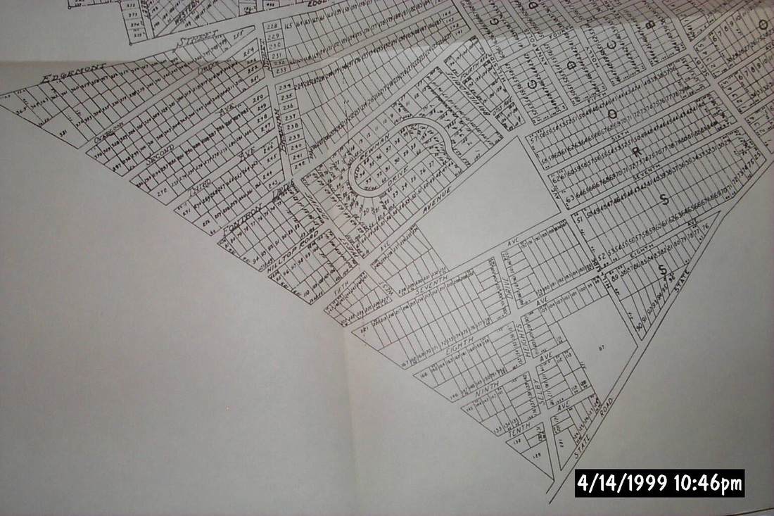
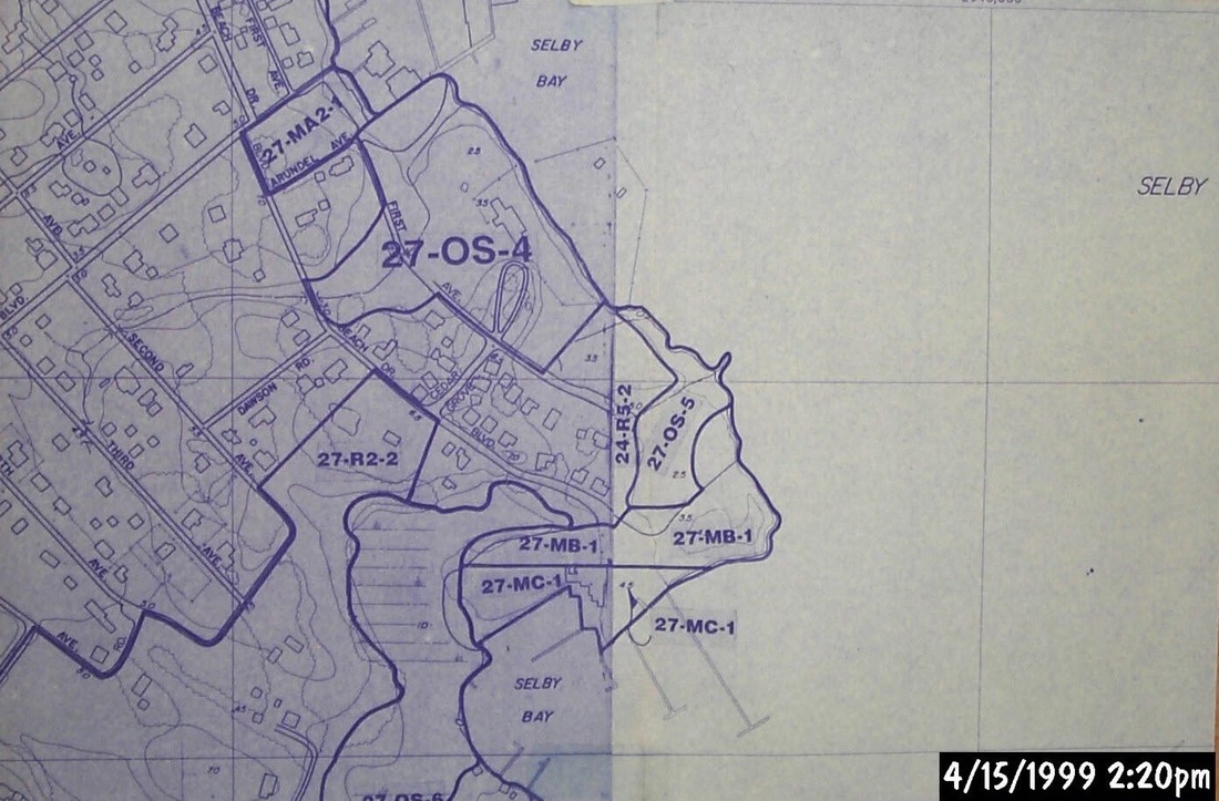
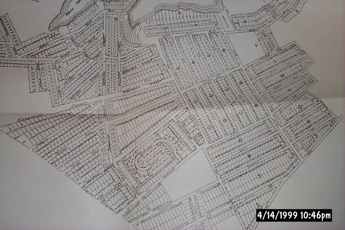
Sectional of Selby Heights April 1999
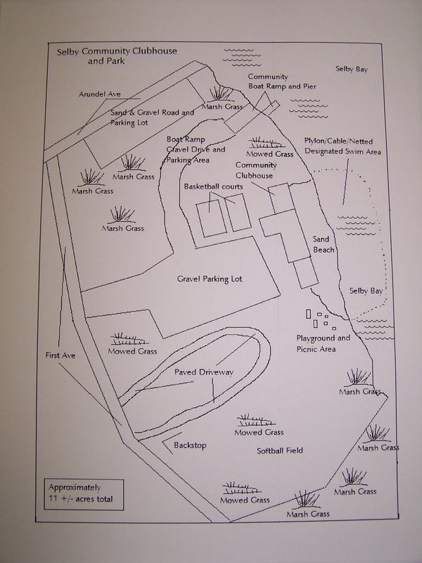
Simple survey of commons area June 2005
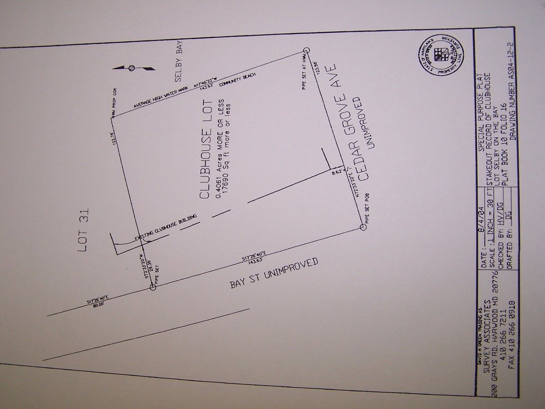
Survey associates special purpose plat of clubhouse for court case August 2004

Sectionalized Selby-On-The-Bay plat Section 1
|
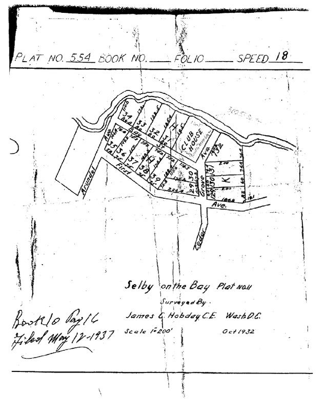
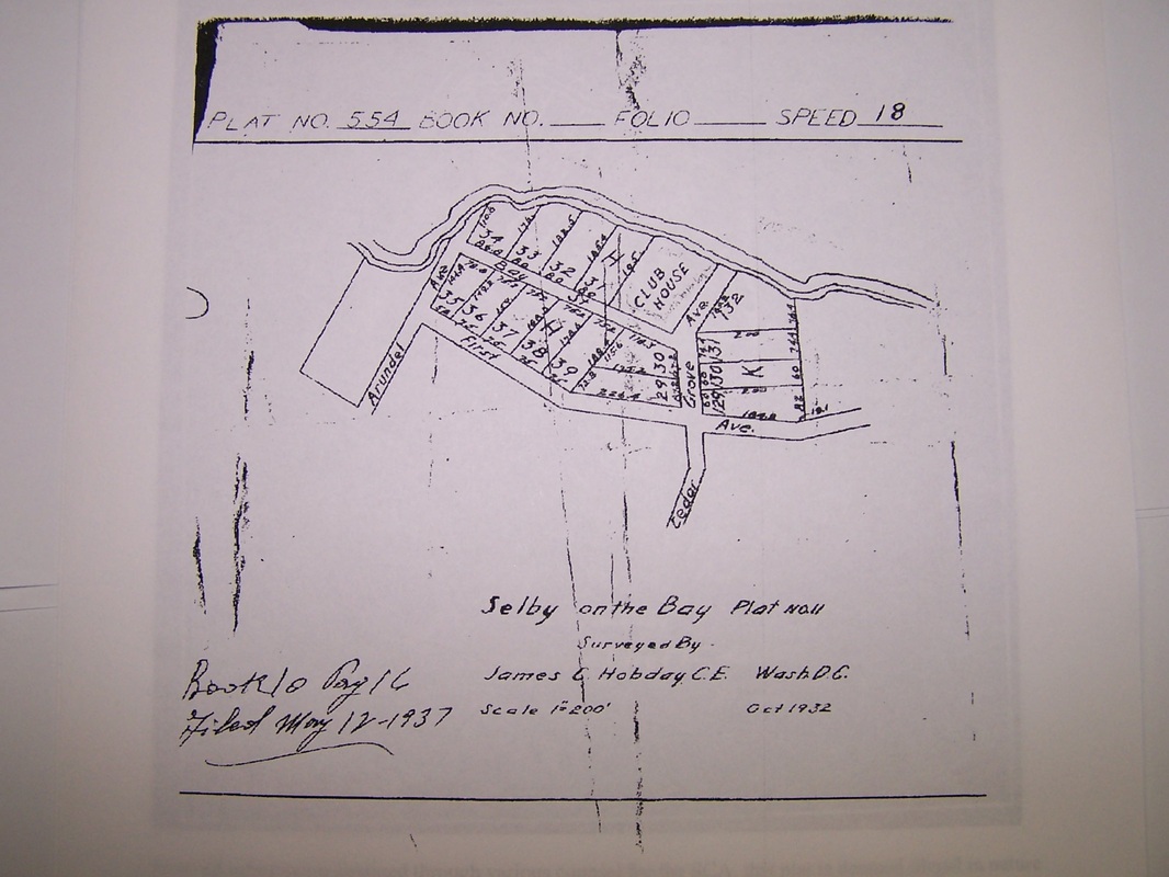
1937 Plat of Commons Area
Plat that started the injunction battle in 1938
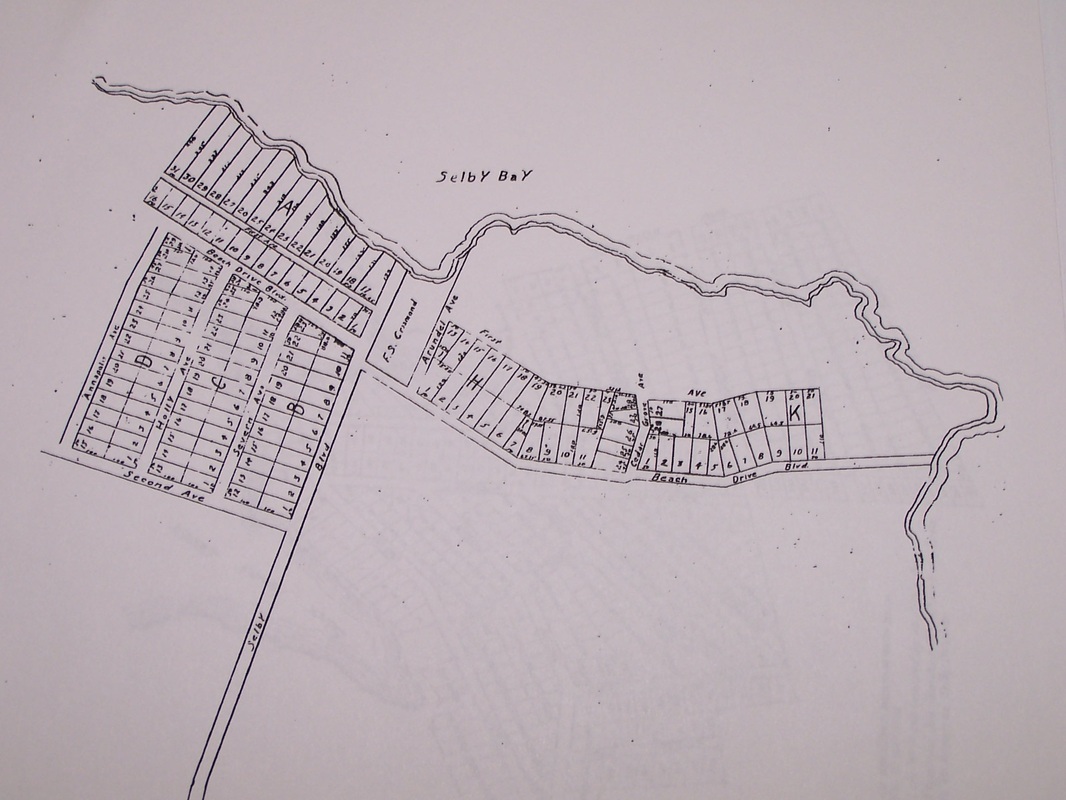
Beach plat subdivided

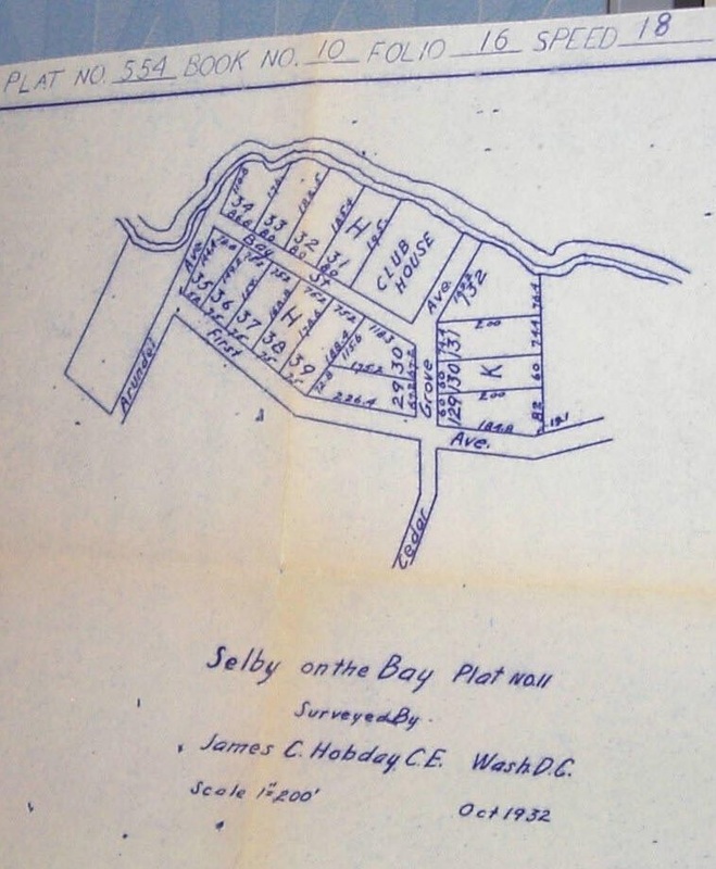
Illegally recorded commons area subdivision October 1932
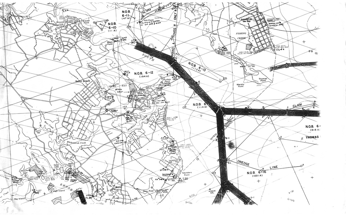
Nautical map of Selby Bay and surrounding
Old draft of commons area showing K-50 boundary lot
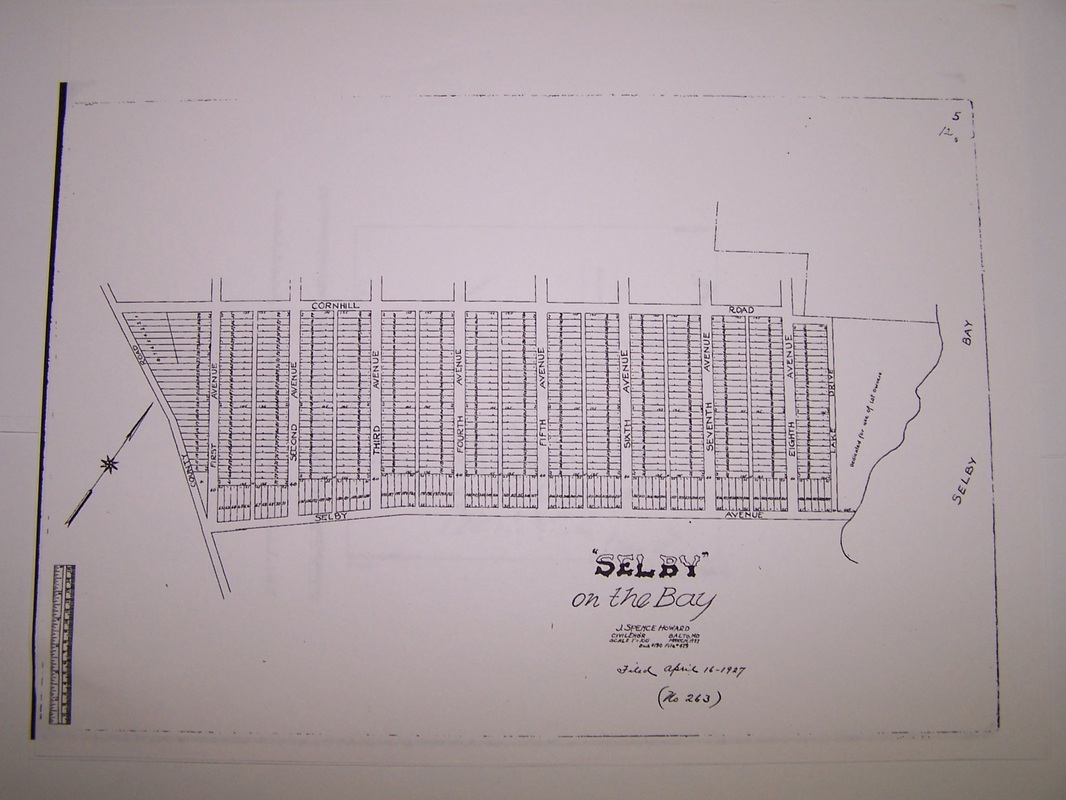
Original Selby-On-The-Bay never used (notice commons area and road designations) April 1927
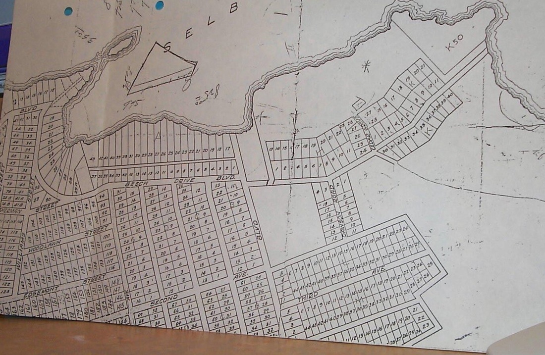
SE border of commons area aka Block K-50 plat

Selby-On-The-Bay neighborhood boundaries without North Selby designated
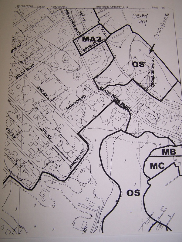
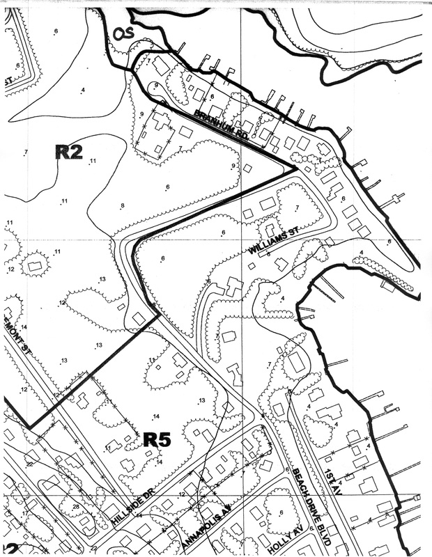
Zoning map of clubhouse and surrounding areas March 2003

Sectionalized Selby-On-The-Bay plat Section 2
|

Another Plat of Selby
1932 Beach Plat without woods
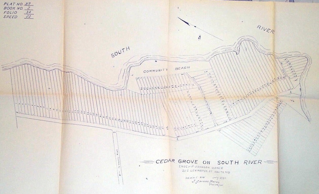
Early Cedar Grove play with owner Enoch Johnson notated April 1923

Illegally divided commons area
Illegally recorded commons area subdivision October 1932
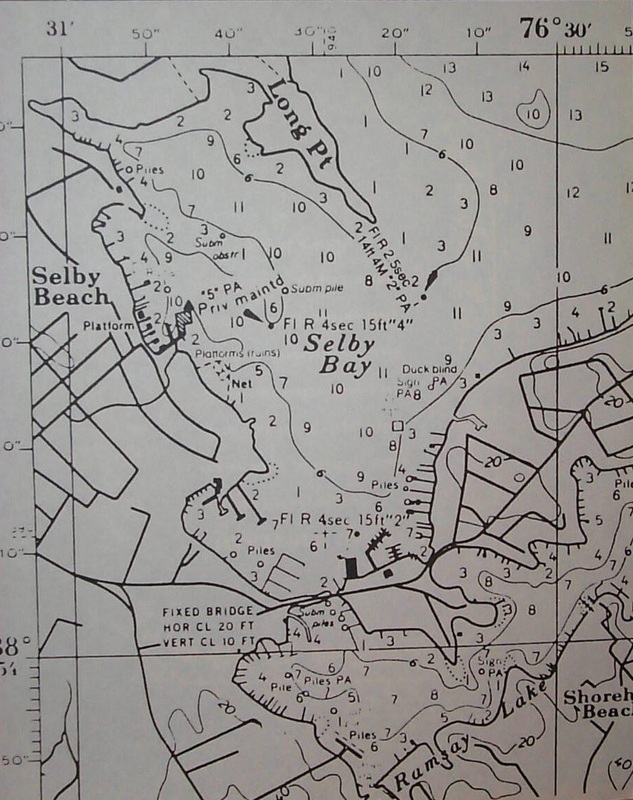
Nautical map showing water depths in Selby Bay area
Older 100 year flood plain map
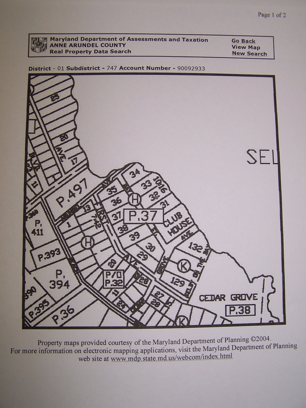
SDAT area map of Selby 1999
Sectional of North Selby April 1999

Selby Heights and North Selby April 1999

Zoning map of common area

Sectionalized Selby-On-The-Bay plat section 3
|
Commons Area Plat From AACo Real Property Search Records 120509
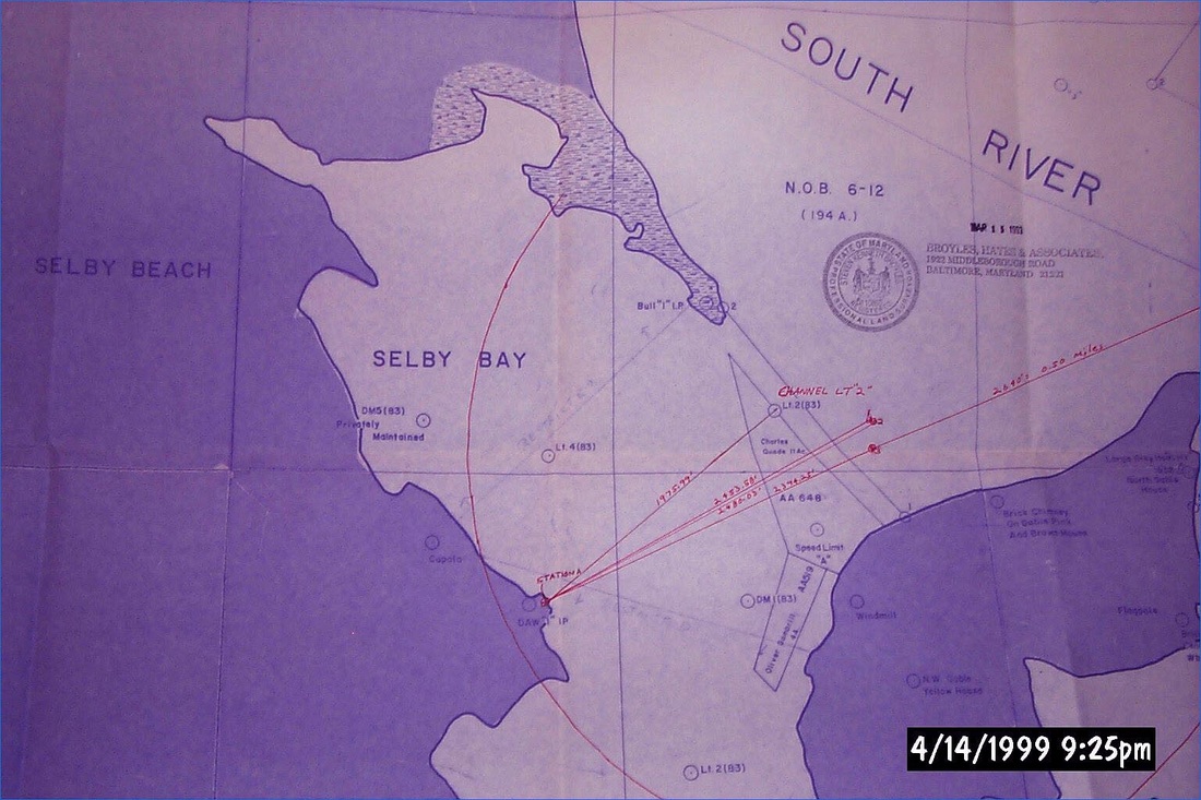
AACo Nautical Map Selby Bay AA-3 1999
Early Selby Heights plat
Illegally recorded commons area subdivision plat of 1932 showing filing date of 1937
North Selby January 1932
Original plat without commons area notated 1929
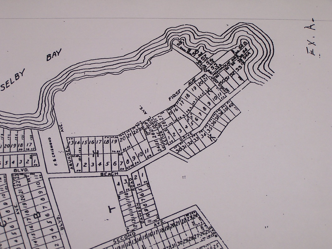
Partial original 1930 Selby-On-The-Bay plat with emphasis on commons area - exhibit A for court case

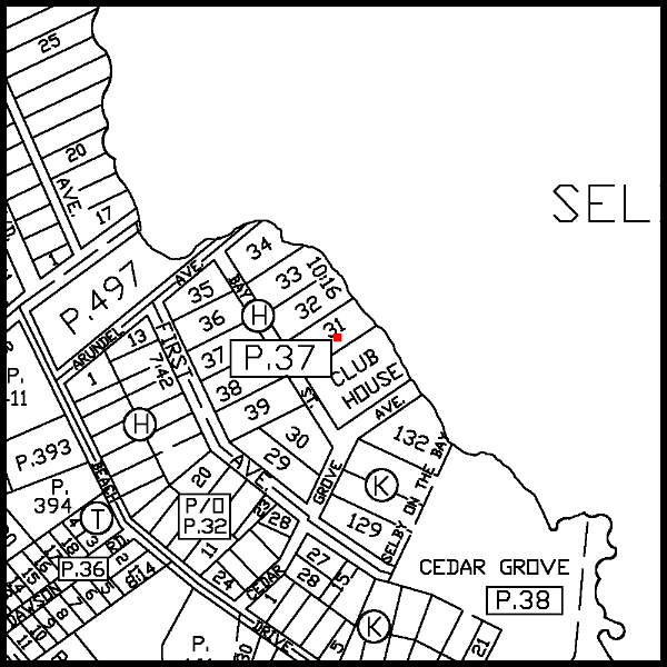
Sectional of commons area and surrounding lots April 1999
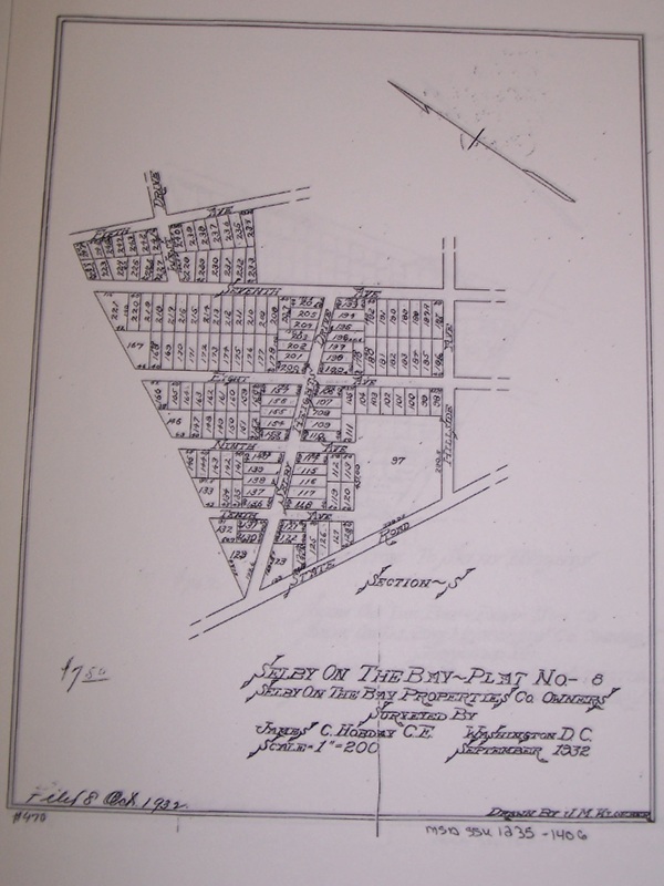
Selby Heights plat September 1932
Sectionalized Selby-On-The-Bay plat section 4
|
Plat of North Selby
AACo Zoning Map (Selby and Vicinity) 1999

Federal 100 year flood plain zoning map 1999
Plat from AACo land records from real property website
Illegally subdivided commons area never recorded October 1932
North Selby marked up with changes January 1932
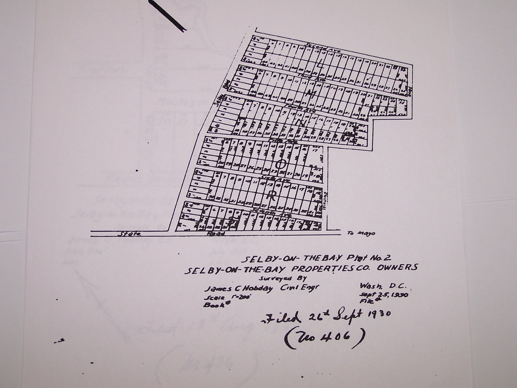
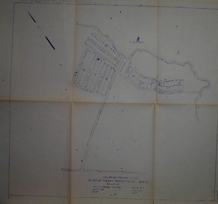
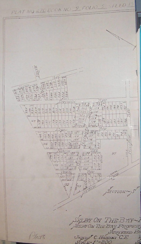
Original Selby-On-The-Bay plat September 1930
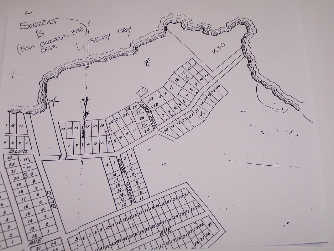
Partial original 1930 Selby-On-The-Bay plat with emphasis on commons area - exhibit B of 1938 injunction case
Sectional of Selby proper, Selby Heights and North Selby April 1999
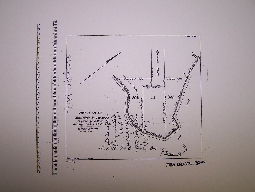
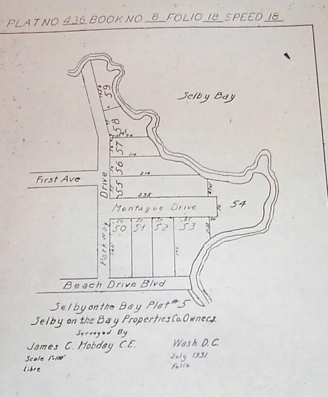
Subdivision of parcel K-54
|